Is that headline bold enough? If you think it’s arrogant then you haven’t visited our local Geographic Information System (GIS) “MapsOnline“. Go visit our system and then go to any other county system. If you can even find it you’ll understand instantly why ours is BEST!
 MapsOnline is wonderful for seeing what your lot looks like, finding out who owns property around you. Getting hundreds of layers of information from Aerials To Zoning and everything in between. Want to look up recent property sales? How about see what your subdivision looks like? Want to see your lot? Curious about priority habitat’s? Endangered species? All this and more is available.
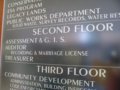
 The GIS department falls under the Department of Assessment and GIS which is headed up by our Assessor Linda Franklin. If you want to visit the GIS department you can find them on the second floor of the Public Service Center. You can visit Clark County GIS homepage for all the services they provide and links to tons of great resources.
If you have questions about using the GIS MapsOnline feel free to give me a call. I’m happy to help answer your questions. Not only am I a regular user, I’m also a past GIS employee. Yes, I had the privilege of working for this incredible department with some wonderful people. As a Land Record Technician I was part of a team that maintained the entire parcel level and ownership of real property. I have 8 years of experience here. So, I have a pretty good idea about how things work. Go check it out. You won’t be disappointed!


Leave A Comment
You must be logged in to post a comment.